Hazard Reduction Burn in Royal National Park Loftus Trails -COMPLETED-trails are OPEN

dcrofty

Eats Squid
UPDATE 19-9-12 All trails in the burn block are open.


Hi All,

NPWS and other fire services are planning a large hazard reduction burn in the Royal National Park. Most of the trails in the Grays Point to Loftus area will be affected. See the map below for the area covered.


I'll post closer to the date with an update but perhaps it might be good for people thinking of riding Royal that weekend to keep an eye on the park website prior to heading out.

If it goes ahead the burn will start on either Friday or Saturday and will take several days to finish. It is also anticipated that the mop up phase might last up to a week and that trails might be closed during this period until they can be assessed for things like dangerous trees etc.


Map of area covered
Temptation Creek Burn Area.jpg
 
Last edited:

dcrofty

Eats Squid
Bump.

Looking less and less likely that this will happen this weekend but this is to be confirmed.

Will happen at some point though.
 

dcrofty

Eats Squid
So, unsurprisingly, this event has been postponed, possibly until spring. Will bump when its next scheduled.
 

dcrofty

Eats Squid
Update

NPWS are now looking at conducting this burn on the weekend of the 1st and 2nd of September so best to avoid the area for those days.

I will confirm closer to the date whether this is going ahead on those dates.
 

dcrofty

Eats Squid
Date Confirmed

Date of Saturday 1st Sunday the 2nd and Monday 3rd now confirmed for this burn, weather permitting.

Please also note the trails will likely be closed for at least a week afterwards whilst things like danger trees are removed etc.

Will update as date gets closer.
 

dcrofty

Eats Squid
Confirmed- Burn this weekend

This burn will be occuring this weekend. No access to trails in the Loftus Oval, Temptation Creek, Grays Point or Kirrawee area for probably at least a week.
 

Halo1

Likes Bikes and Dirt
This burn will be occuring this weekend. No access to trails in the Loftus Oval, Temptation Creek, Grays Point or Kirrawee area for probably at least a week.
Any one know if the trails will be open on Friday 31st August?
 

Halo1

Likes Bikes and Dirt
Yes they will be. Closures start Saturday morning. Get that last ride in!

We got the last ride in!!!!!

I think this track is part of the burn so I am hoping I captured the before picture and will head in a few weeks to get the after burn picture.

Royal MTB BURN2.jpg

The tracks are in great condition, we noticed lots of improvements since the last time we rode there.
 

willsy01

Eats Squid
I think this track is part of the burn so I am hoping I captured the before picture and will head in a few weeks to get the after burn picture.

View attachment 243374

The tracks are in great condition, we noticed lots of improvements since the last time we rode there.
Yes, it is part of the burn......the trail fairies have done EXCELLENT work over the ast 6 months, especially considering the increased traffic after the closure of Menai.
 

Mr_Max

Squid
Spewing I am meant to be riding there tomorrow. However I had an early ride there today. Its looking pretty good. Some berms here and there would be a good idea?IMG_2934.jpg
 

dcrofty

Eats Squid
Hi all, apologies for the late advice (was out of internet range yesterday at a different HR burn) but as some of you have already noticed the burn didn't happen today, strong winds were predicted and indeed eventuated.

As already mentioned plan is now for next weekend. I will update as any more news comes to hand.


I think this track is part of the burn so I am hoping I captured the before picture and will head in a few weeks to get the after burn picture.
I think some people call that section Blair Witch. I should clarify that the section of bush (including the trail shown in your photo) won't be burnt. The burn area is the northern side of the tram lines but that section of bush and trail will be closed during the burn as the trail comes out at the burn edge and as there will be firefighters and trucks working in that area it will be closed to public for the duration. The map in the first post shows the burn area, the map from NPWS shows the areas closed to the public during burning operations. Any questions post here.

Spewing I am meant to be riding there tomorrow. However I had an early ride there today. Its looking pretty good. Some berms here and there would be a good idea?
Thanks for the comments re the trails, its good to know that the work thats been done is appreciated. There is a small group of volunteers who carry out maintenance of the trails and who are always looking for assistance. More info in this thread
 

bigdamo

Likes Dirt
There is a group of riders who not content riding(illegally) a walking trail have in the last few weeks started to move rocks around to make it easier for them to ride this trail in the proposed burn off area close to Kirrawee.I ride (on the legal tracks) and also walk the trails I live close to the entrance to the park at Kirrawee.

On one of my walks I came across some RNP employees surveying the proposed burn off area they where checking out the handy work of these idiots attempts to build a MTB trail illegally .They were not impressed.One of the things they were talking about was closing the whole of the RNP off to MTBers.

Why is that a small minority :wacko: spoil it for the rest of the sport.

I hope these idiots don't after the burnoff take the opportunity to build new tracks while the undergrowth is cleared.You are being watched who do you think moved your rocks and it wasn't me.

Mtbers have lost Menai do you want to loose the RNP too.
 

Cronar

Likes Dirt
Which trail are you referring to Bigdamo, the Walls (cliffs) or the one that comes down the other side of that valley? Is the trail clearly marked as a no go zone for bikes, quite a few of the illegal trails aren't signposted. With the large influx of newer riders into the park recently perhaps the people responsible are not aware of the sensitive nature of the park

I hear what you are saying about the actions of a few impacting on everyone, But the short sightedness of the npws also pisses me off ... We have a small issue with riders on an illegal trail ... Ban all the riders! If they close the park to riders illegal trail building will explode as there are very few other local options.

Whatever happened to this:
http://www.theleader.com.au/news/local/news/general/mountain-biking-on-track-in-royal/1942757.aspx
The trail network at the moment is far from a "world class experience" (no disrespect to the trail fairies, you guys work wonders with limited resourses)
 

bigdamo

Likes Dirt
Which trail are you referring to Bigdamo, the Walls (cliffs) or the one that comes down the other side of that valley? Is the trail clearly marked as a no go zone for bikes, quite a few of the illegal trails aren't signposted. With the large influx of newer riders into the park recently perhaps the people responsible are not aware of the sensitive nature of the park

I hear what you are saying about the actions of a few impacting on everyone, But the short sightedness of the npws also pisses me off ... We have a small issue with riders on an illegal trail ... Ban all the riders! If they close the park to riders illegal trail building will explode as there are very few other local options.

Whatever happened to this:
http://www.theleader.com.au/news/local/news/general/mountain-biking-on-track-in-royal/1942757.aspx
The trail network at the moment is far from a "world class experience" (no disrespect to the trail fairies, you guys work wonders with limited resourses)
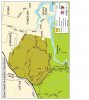
I am not going to exactly pinpoint the trail then you will have other people looking for it.It is close to Savilles creek however.Not far away from the Walls(cliffs or steps of insanity)

"Is the trail clearly marked as a no go zone for bikes, quite a few of the illegal trails aren't signposted.

"Um Mtber's have been removing the signs saying "no MTB's walking trail only" for years in this area.I guess this doesn't help the MTB in the Royal cause.But yes to enter this area you probably go past a sign makes no difference if it was (which it isn't) a legal MTB trail it would be signposted and they don't pull down those signs.It is clearly not a MTB trail.

"If they close the park to riders illegal trail building will explode as there are very few other local options."

You think so.I was up riding up at East Heathcote this morning they used to have a problem a few years ago with BMX and dirt jumpers building illegal tracks.Not anymore NPWS just kept at them.

Moto's were a problem in RNP and Heathcote NP quite a few years ago not anymore NPWS and the police just kept at them.

Horses were a problem on the trails around East Heathcote quite a few years ago not anymore NPWS just kept at them.

It amazes me people think it is their right to do anything they want in a National park we MTBers are lucky we have got what we have in the Royal but if MTBers keep building illegal tracks you might find you won't be riding there anymore and "there are very few other local options" ain't gunna cut it as an excuse.Trust me Moto's tried that one many,many years ago.The general public couldn't give a hoot if Mtbers have no where to ride.

That article you posted was from 2010 at that time I'm pretty sure the Royal didn't have a General manager I'm guessing they have one now is he or she MTB friendly.

"But the short sightedness of the npws also pisses me off "

It might piss you off but step back and take a look at what Mr and Mrs joe public and some people in the NPWS might think of MTB in National parks and you might be surprised.One of my neighbors just hates Mtb's and the only thing he hates more is MTb in the royal and he is a retired National parks ranger.He likes fighting causes luckily he is fighting another cause at present but soon will be finished it.I hate to think what he would do if he saw illegal Mtb tracks in the Royal especially if once the burnoff is done and new illegal tracks start popping up there real easy to see when everything has been burnt off.
 
Last edited:

dcrofty

Eats Squid
Bump to the top.

Burn still planned for this coming weekend at this point although its being constantly assessed with respect to forecast winds and dropping fuel moisture levels.

Stay tuned for updates.

Crofty
 

dcrofty

Eats Squid
Burn now Sunday 9th Sept and Monday 10th

NPWS notice below
crofty


Hello everyone

Please be advised that due to unfavourable conditions the hazard reduction burn proposed for Saturday 8th and Sunday 9th of September has now been rescheduled for Sunday 9th and Monday 10th of September.


As the scheduling of the burn is dependant on weather conditions this will be reassessed on Friday afternoon when the special weather forecast for the local area is available.

For up to date information on all hazard reduction burns and wildfires refer to RFS website www.rfs.nsw.gov.au or phone the bushfire information line on 1800 679 737
 
Top